Warm mid-Spring expected
March 22, 2021
by Thomas Kovacs
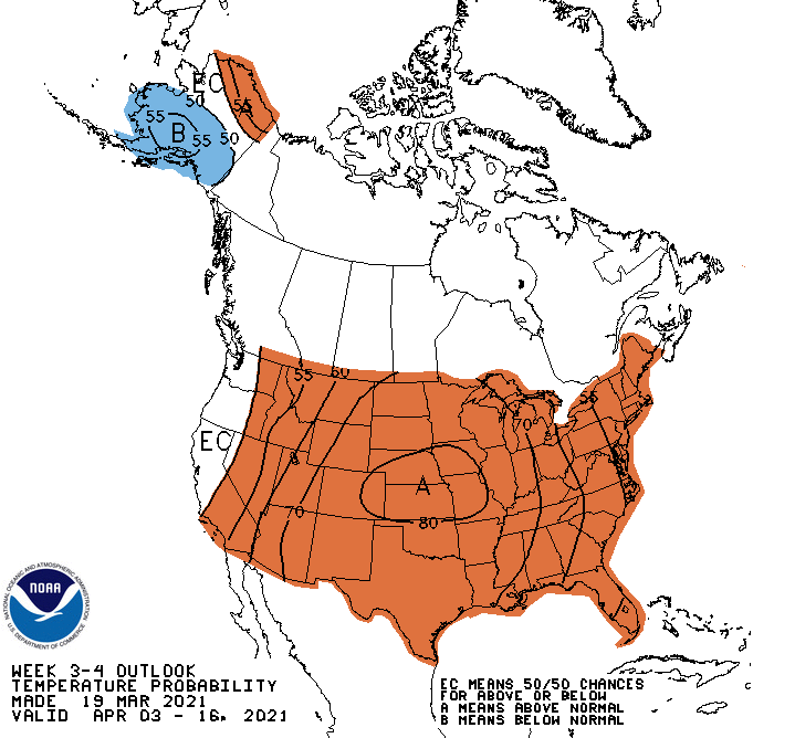
Warm temperatures are expected to continue in April after a period of near-normal conditions to end March. These conditions are expected because of the formation of a rather strong ridge in the jet stream level. Ridges, which are wave crests or northward bulges of jet stream air, often go together with warm air. The ridge is expected to start developing in the west where drought conditions persist and expand eastward where drought conditions have been developing. See the Drought Monitor map below of drought conditions as of March 16, 2021.
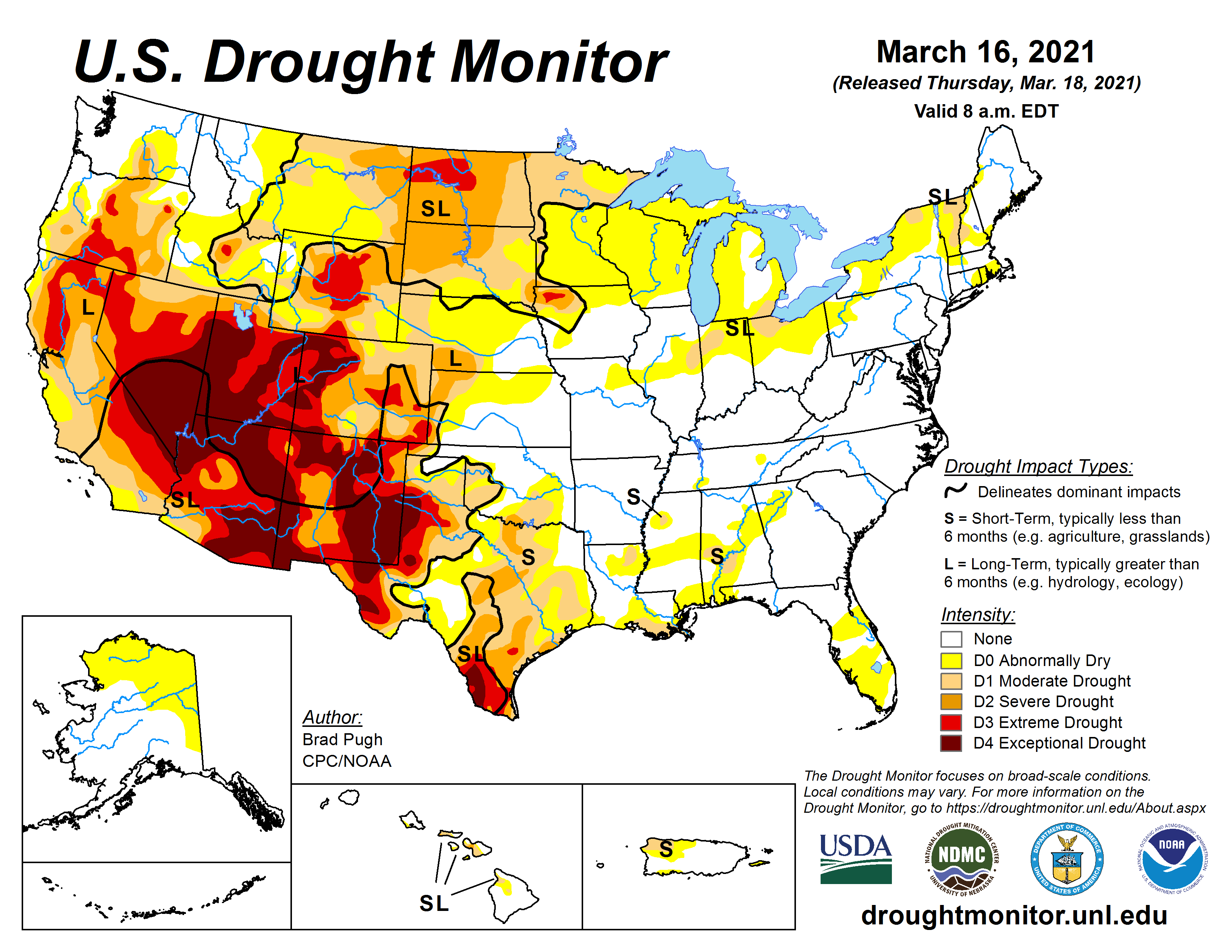
The U.S. Drought Monitor is jointly produced by the National Drought Mitigation Center at the University of Nebraska-Lincoln, the United States Department of Agriculture, and the National Oceanic and Atmospheric Administration. Map courtesy of NDMC.
Drought conditions often produce warmer than normal temperatures as energy from the sun is no longer partitioned between evaporating ground moisture and warming the ground. The dry conditions and lack of snow cover in the central U.S. of late helps the ridge to expand eastward. Strong ridges are often persistent and are an example of what weather broadcasters often refer to as a "weather pattern". The best chance for above-normal temperatures are expected from the beginning to the middle of April (April3-17, 2021) with the highest probabilities (60-70%) of above average temperatures expected then (see the NOAA Climate Prediction Center 3-4 week outlook below). These probabilities are some of the highest probabilities that you will see for a 3-4 week forecast.